ESA Observing the Earth 
zdroje zpráv:
ESA’s Biomass mission launches on Vega-C
29.4.2025 11:30 Video:
00:02:01
ESA’s state-of-the-art Biomass satellite has launched aboard a Vega-C rocket from Europe’s Spaceport in French Guiana. The rocket lifted off on 29 April 2025 at 11:15 CEST (06:15 local time).
In orbit, this latest Earth Explorer mission will provide vital insights into the health and dynamics of the world’s forests, revealing how they are changing over time and, critically, enhancing our understanding of their role in the global carbon cycle. It is the first satellite to carry a fully polarimetric P-band synthetic aperture radar for interferometric imaging. Thanks to the long wavelength of P-band, around 70 cm, the radar signal can slice through the whole forest layer to measure the ‘biomass’, meaning the woody trunks, branches and stems, which is where trees store most of their carbon.
Vega-C is the evolution of the Vega family of rockets and delivers increased performance, greater payload volume and improved competitiveness.
ESA’s Biomass mission launches on Vega-C
29.4.2025 11:30 Video:
00:02:01
ESA’s state-of-the-art Biomass satellite has launched aboard a Vega-C rocket from Europe’s Spaceport in French Guiana. The rocket lifted off on 29 April 2025 at 11:15 CEST (06:15 local time).
In orbit, this latest Earth Explorer mission will provide vital insights into the health and dynamics of the world’s forests, revealing how they are changing over time and, critically, enhancing our understanding of their role in the global carbon cycle. It is the first satellite to carry a fully polarimetric P-band synthetic aperture radar for interferometric imaging. Thanks to the long wavelength of P-band, around 70 cm, the radar signal can slice through the whole forest layer to measure the ‘biomass’, meaning the woody trunks, branches and stems, which is where trees store most of their carbon.
Vega-C is the evolution of the Vega family of rockets and delivers increased performance, greater payload volume and improved competitiveness.
Biomass poised for liftoff to unveil forest secrets
28.4.2025 9:00
After years of careful design and preparation, ESA’s Earth Explorer Biomass satellite is set for launch tomorrow, 29 April at 11:15 CEST, aboard a Vega-C rocket from Europe’s Spaceport in French Guiana.
This groundbreaking mission will offer unprecedented insights into the state and evolution of the world’s forests. By mapping the woody material in Earth’s forests, this revolutionary satellite will play a crucial role in deepening our understanding of how forests influence the global carbon cycle.
Earth from Space: French Guiana
25.4.2025 10:00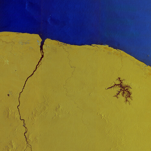 Image:
Copernicus Sentinel-1 captured this radar image over French Guiana – home to Europe’s Spaceport in Kourou, where ESA’s Biomass mission is being prepared for liftoff on 29 April onboard a Vega-C rocket.
A new space age for forests – but groundwork still matters
24.4.2025 14:35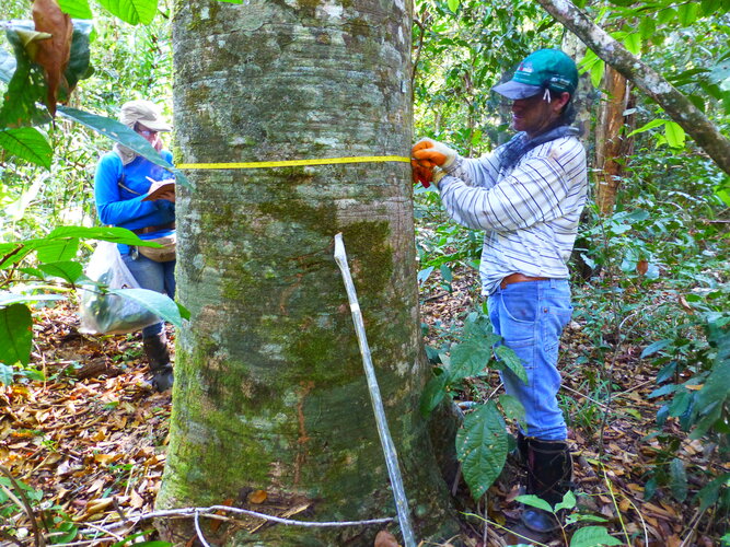
A new era of forest monitoring is quite literally taking off, ushering in what scientists are calling the ‘forest space age’. On April 29, ESA will launch its revolutionary Biomass mission, the first satellite to carry a P-band radar into space – technology that is set to transform how we understand forests and the carbon they store. Along with other space agencies’ instruments already in orbit or soon to be launched, there has never been so many ‘eyes in the sky’ focused on forests.
Yet, the work of people on the ground –often in the most remote and challenging forest regions – also remains essential.
Watch Biomass launch live
24.4.2025 11:50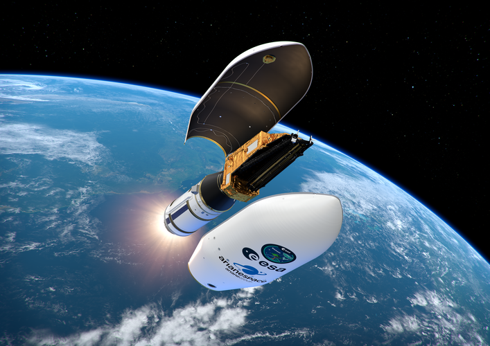
ESA's Biomass mission is on the launch pad at Europe’s Spaceport in Kourou, French Guiana. Don’t miss the live coverage of liftoff on Tuesday 29 April, on ESA WebTV. Coverage will start at 10:55 CEST with commentary live from Kourou and ESA’s European Space Operations Centre in Germany. The Vega-C rocket carrying Biomass is scheduled for liftoff at 11:15.
Sentinel-1 captures ground shift from Myanmar earthquake
24.4.2025 8:36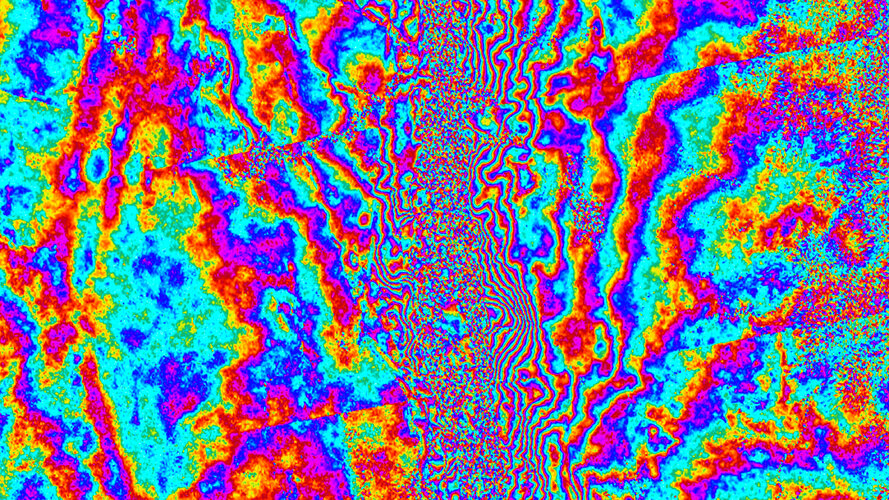
On 28 March 2025, a powerful magnitude 7.7 earthquake struck central Myanmar, sending shockwaves through the region. While the country is still dealing with the devasting aftermath, scientists have used radar images from the Copernicus Sentinel-1 satellites to reveal a detailed picture of how the ground shifted as a result of the quake – offering new insights into the mechanics of the tectonic Sagaing Fault and the scale of the seismic rupture.
Final preparations for Biomass operations
23.4.2025 16:38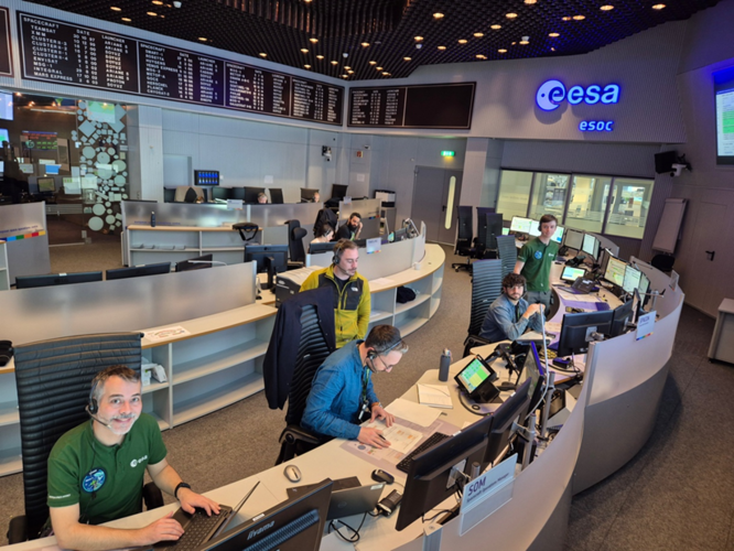
As the launch of the Biomass satellite approaches, the excitement is palpable at ESA’s European Space Operations Centre (ESOC) in Darmstadt, Germany. Over the winter months, a dedicated team has been meticulously preparing for the satellite's critical "Launch and Early Orbit" phase (LEOP).
Final preparations for Biomass operations
23.4.2025 16:38
As the launch of the Biomass satellite approaches, the excitement is palpable at ESA’s European Space Operations Centre (ESOC) in Darmstadt, Germany. Over the winter months, a dedicated team has been meticulously preparing for the satellite's critical "Launch and Early Orbit" phase (LEOP).
Lifting the canopy on Earth’s forests
23.4.2025 9:30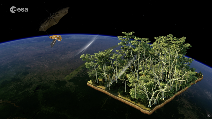 Video:
00:02:22
ESA’s state-of-the-art Biomass mission has been designed to shed new light on the health and dynamics of the world’s forests, revealing how they are changing over time and, critically, enhancing our understanding of their role in the global carbon cycle. It is the first satellite to carry a fully polarimetric P-band synthetic aperture radar for interferometric imaging. Thanks to the long wavelength of P-band, around 70 cm, the radar signal can slice through the forest canopy and whole forest layer to measure the ‘biomass’, meaning the woody trunks, branches and stems, which is where trees store most of their carbon.
Next generation scientists set sail to harness space for oceans
22.4.2025 16:00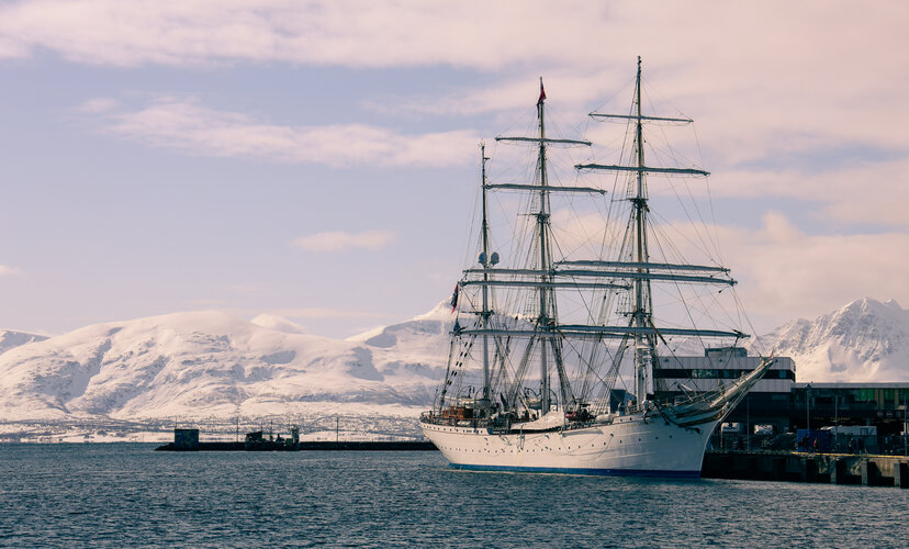
A new wave of ocean scientists has embarked on an extraordinary six-week voyage aboard a majestic tall ship that set sail today from Norway bound for southern France. But this is no ordinary journey.
Thanks to this ESA Advanced Ocean Training Course, these upcoming researchers will be taking a deep dive into ocean science, empowering them with skills to harness satellite data for research, innovation and sustainable development – and preparing them to become tomorrow’s leaders and ambassadors for ocean science.
Next-generation scientists set sail to harness space for oceans
22.4.2025 16:00
A new wave of ocean scientists has embarked on an extraordinary six-week voyage aboard a majestic tall ship that set sail today from Norway bound for southern France. But this is no ordinary journey.
Thanks to this ESA Advanced Ocean Training Course, these upcoming researchers will be taking a deep dive into ocean science, empowering them with skills to harness satellite data for research, innovation and sustainable development – and preparing them to become tomorrow’s leaders and ambassadors for ocean science.
Biomass on the launch pad
22.4.2025 15:30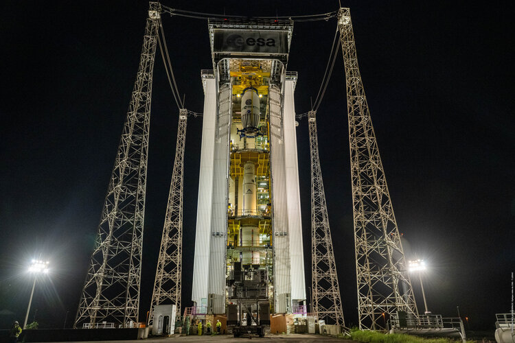 Image:
ESA’s Biomass satellite, encapsulated within a Vega-C rocket fairing, has been rolled out to the launch pad at Europe’s Spaceport in French Guiana ahead of liftoff, planned for 29 April at 11:15 CEST.
ESA and IBM collaborate on TerraMind
22.4.2025 10:42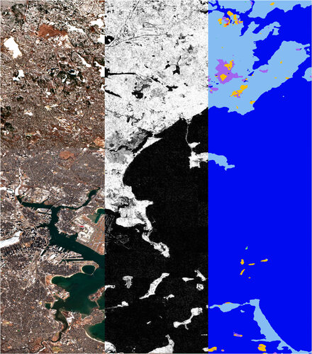
The first version of TerraMind, a powerful next-generation AI model designed to help us better understand and protect our planet, was released today.
Earth from Space: Giza, Egypt
18.4.2025 10:00 Image:
This very high-resolution image captures the Egyptian city of Giza and its surrounding area, including the world-famous Giza Pyramid Complex.
Sea surface warming faster than expected
17.4.2025 17:00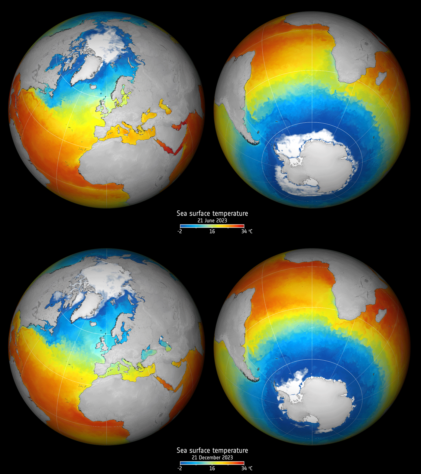
Satellite observations show that sea-surface temperatures over the past four decades have been getting warmer at an accelerated pace.
Register now for ESA’s Living Planet Symposium in Vienna
17.4.2025 9:25
Registrations are now open for the European Space Agency’s Living Planet Symposium (LPS) – one of the largest Earth observation conferences in the world. The event will take place on 23–27 June 2025 in Vienna, Austria.
Forest mission sealed within rocket fairing for liftoff
16.4.2025 13:45
With the launch of ESA’s Biomass satellite scheduled for 29 April, preparations at Europe’s Spaceport in Kourou, French Guiana, have reached a key milestone. The satellite has now been sealed inside the protective fairing of the Vega-C rocket – now hidden from view, the satellite is almost ready for its journey into space.
Meet Biomass
15.4.2025 17:00 Video:
00:00:53
Meet Biomass – ESA’s next Earth Explorer mission to launch. Carrying the first P-band synthetic aperture radar in space, this new mission is set to deliver crucial information about the state of our forests and how they are changing, and to further our knowledge of the role forests play in the carbon cycle.
Protecting ocean biodiversity with satellite data
15.4.2025 15:05
An ESA-funded study that used satellite data to define biodiversity zones and shipping lanes in the Atlantic Ocean suggests it is possible to protect 30% of ocean habitats, with little impact on fishing and shipping.
Media advisory: Earth Explorer Biomass satellite launch media events
14.4.2025 15:57
Media advisory
Earth Explorer Biomass satellite launch media events
Earth from Space: Great Barrier Reef, Australia
11.4.2025 10:00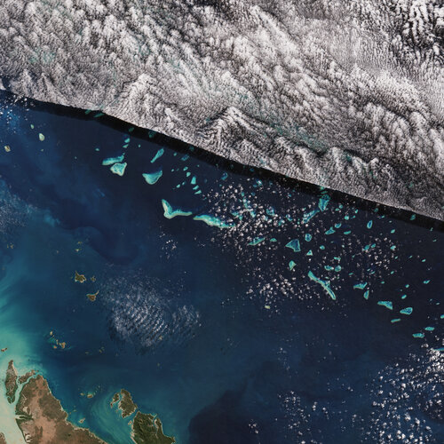 Image:
This Copernicus Sentinel-2 image shows part of one of the world’s natural wonders – the Great Barrier Reef in the Coral Sea off the east coast of Queensland, Australia.
Zoom in to explore this image at its full resolution or click on the circles to learn more.
The Great Barrier Reef extends for nearly 2300 km and covers an area of more than 344 000 sq km, approximately the size of Italy. It is the largest living organism on Earth and the only living thing the naked eye can see from space.
Despite its name, the Great Barrier Reef is not a single reef, but an interlinked system of about 3000 reefs and 900 coral islands, divided by narrow passages. An area of biodiversity equal in importance to tropical rainforests, the reef hosts more than 1500 species of tropical fish, 400 types of coral, hundreds of species of bird and seaweed and thousands of marine animals, including sharks, barracuda and turtles.
In recognition of its significance the reef was made a UNESCO World Heritage Site in 1981.
The section of reef seen here is the southern part off the coast of the Shire of Livingstone in Central Queensland. Part of the mainland and the islands surrounding the coast are visible in the bottom left corner. The tan-coloured sea along the coasts is due to sediment in the water.
A chain of small coral islands can be seen scattered across the centre of the image. The blue hues of the coral contrast with the dark waters of the Coral Sea.
Part of the reef is covered by clouds dominating the upper part of the image. The clouds form a surprisingly straight line, also visible as a distinct shadow cast over the islands below.
Coral reefs worldwide suffer regular damage due to climate change, pollution, ocean acidification and fishing. Furthermore, they are increasingly under threat from coral bleaching, which occurs when the algae that makes up the coral die, causing it to turn white. This phenomenon is associated with increased water temperatures, low salinity and high sunlight levels.
While these coral reefs are ecologically important, they are difficult to map from survey vessels or aircraft because of their remote and shallow location. From their vantage point in space, Earth-observing satellites such as Copernicus Sentinel-2, offer the means to monitor the health of reefs across the globe.
Earth from Space: Great Barrier Reef, Australia
11.4.2025 10:00 Image:
This Copernicus Sentinel-2 image shows part of one of the world’s natural wonders – the Great Barrier Reef in the Coral Sea off the east coast of Queensland, Australia.
Biomass fully loaded
10.4.2025 9:59
Marking a major milestone in the preparation of ESA’s Biomass satellite for its scheduled 29 April liftoff, experts have completed the critical and hazardous process of fuelling the satellite.
Weather, climate and air quality missions on display
8.4.2025 14:40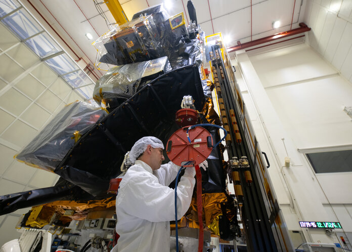
The first of the new generation of MetOp satellites, MetOp-SG Satellite-A, together with the instrument for the Copernicus Sentinel-5 mission, are now ready to be shipped to their launch site. But before the last leg of their terrestrial journey, they were on display to the media at Airbus’s facilities in Toulouse, France.
Earth from Space: The shrinking Aral Sea
4.4.2025 10:00 Image:
The Copernicus Sentinel-2 mission shows us what is left of the Aral Sea, once the fourth largest lake in the world.
Earth Observation Excellence Award 2025 winners
3.4.2025 16:00
In recognition of outstanding contributions to scientific advancement and innovation using Earth observation data, the ESA Earth Observation Excellence Award is presented annually to early-career researchers.
Earth Observation Excellence Award 2025 winners
3.4.2025 16:00
In recognition of outstanding contributions to scientific advancement and innovation using Earth observation data, the ESA Earth Observation Excellence Award is presented annually to early-career researchers.
How hidden lakes threaten Antarctic Ice Sheet stability
3.4.2025 10:00
For decades, satellites have played a crucial role in our understanding of the remote polar regions. The ongoing loss of Antarctic ice, owing to the climate crisis, is, sadly, no longer surprising. However, satellites do more than just track the accelerating flow of glaciers towards the ocean and measure ice thickness.
New research highlights how ESA’s CryoSat mission has been used to uncover the hidden impact of subglacial lakes – vast reservoirs of water buried deep under the ice – that can suddenly drain into the ocean in dramatic outbursts and affect ice loss.
ESA’s Arctic Weather Satellite hailed as excellent
31.3.2025 10:53
Launched just seven months ago, ESA’s Arctic Weather Satellite has been proving how the New Space approach can accelerate the development of missions capable of delivering detailed temperature and humidity profiles for short-term weather forecasts.
Moreover, the impact of this tiny prototype satellite goes even further – its measuring instrument has been recognised as able to provide data that’s on a par with traditional large missions.
IRIDE first image presented at ESA–ESRIN
28.3.2025 12:00
The first image from a new Italian Earth observation satellite mission was published today: a high-resolution image of a strip of the Italian peninsular showing the city of Rome at a resolution of 2.66 metres. This is three times higher than the resolution currently available for systematic acquisition over Italy.
Earth from Space: Waza National Park, Cameroon
28.3.2025 10:00 Image:
The Copernicus Sentinel-2 mission captures the striking landscape surrounding the Waza National Park in Cameroon.
Media invitation: meet the new MetOp Second Generation and Sentinel-5 missions
25.3.2025 11:00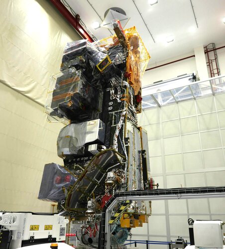
Media invitation
Meet the new MetOp Second Generation and Sentinel-5 missions
Earth from Space: Land of giants
21.3.2025 10:00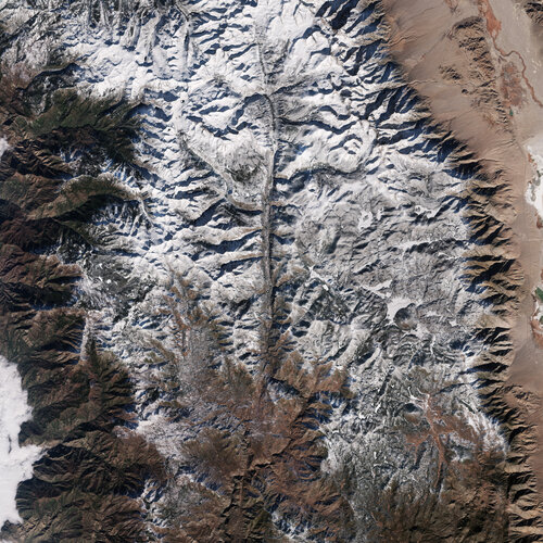 Image:
The Copernicus Sentinel-2 mission takes us over the Sequoia and Kings Canyon National Parks in California’s Sierra Nevada mountains.
Earth from Space: Halong Bay, Vietnam
14.3.2025 10:00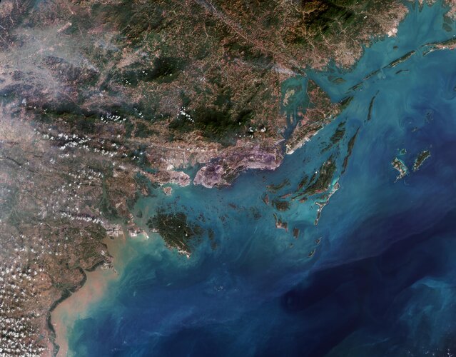 Image:
This Copernicus Sentinel-2 image showcases striking rocky formations amid the blue waters of Halong Bay in northeast Vietnam.
ESA’s pioneering Biomass satellite arrives at launch site
10.3.2025 11:00
Marking another step towards new insights into Earth’s forests and their role in the carbon cycle, ESA’s groundbreaking Biomass satellite has arrived at Europe's Spaceport in French Guiana, to be prepared for liftoff on a Vega-C rocket at the end of April.
Earth from Space: Tirana, Albania
7.3.2025 10:00 Image:
The Copernicus Sentinel-2 mission takes us over Albania’s capital Tirana and its surroundings.
Nord Stream methane leak far bigger than estimated
5.3.2025 15:00
The methane emitted in 2022 by the damaged Nord Stream gas pipelines was more than double the volume estimated at the time, according to a study published in Nature.
Call for interest: Biomass launch media event at Europe’s Spaceport in French Guiana
5.3.2025 10:42
Call for interest
Biomass launch media event at Europe’s Spaceport in French Guiana
Earth from Space: Maha Kumbh Mela festival, India
28.2.2025 10:00 Image:
The Copernicus Sentinel-2 mission captured the Maha Kumbh Mela festival, the world’s largest human gathering, which took place in the city of Prayagraj in northern India.
Earth from Space: Tokyo, Japan
21.2.2025 10:00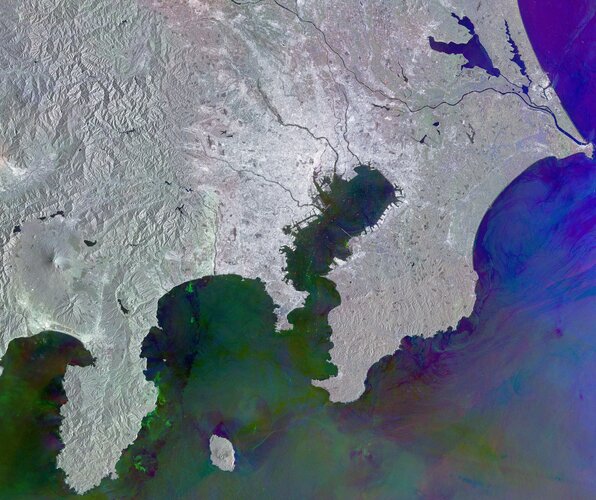 Image:
This Copernicus Sentinel-1 radar image shows Tokyo and its metropolitan area, the largest urban agglomeration in the world.
Two atmospheric missions on one satellite
20.2.2025 14:44
The second of the Meteosat Third Generation (MTG) satellites and the first instrument for the Copernicus Sentinel-4 mission are fully integrated and, having completed their functional and environmental tests, they are now ready to embark on their journey to the US for launch this summer.
Two atmospheric missions on one satellite
20.2.2025 14:44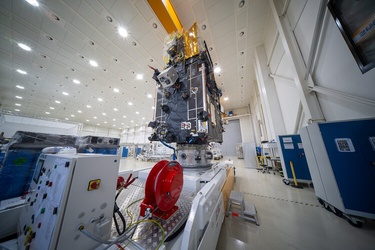
The second of the Meteosat Third Generation (MTG) satellites and the first instrument for the Copernicus Sentinel-4 mission are fully integrated and, having completed their functional and environmental tests, they are now ready to embark on their journey to the US for launch this summer.
Glacier melt intensifying freshwater loss and accelerating sea-level rise
19.2.2025 17:00
Ice melting from glaciers around the world is depleting regional freshwater resources and driving global sea levels to rise at ever-faster rates.
According to new findings, through an international effort involving 35 research teams, glaciers have been losing an average of 273 billion tonnes of ice per year since the year 2000 – but hidden within this average there has been an alarming increase over the last 10 years.
Earth from Space: Heart of Mount St Helens
14.2.2025 10:00 Image:
For Valentine’s Day, the Copernicus Sentinel-2 mission picks out a heart in the landscape north of Mount St Helens in the US state of Washington.
Sentinel-1C demonstrates power to map land deformation
13.2.2025 15:00
Launched just two months ago and still in the process of being commissioned for service, the Copernicus Sentinel-1C satellite is, remarkably, already showing how its radar data can be used to map the shape of Earth’s land surface with extreme precision.
These first cross-satellite ‘interferometry’ results assure its ability to monitor subsidence, uplift, glacier flow, and disasters such as landslides and earthquakes.
Forest mission on show
11.2.2025 10:27
After years of meticulous development, ESA’s next Earth Explorer satellite, Biomass, is ready to be packed up for transport to Europe’s Spaceport in French Guiana, where it will launch aboard a Vega-C rocket this spring.
Before final preparations and shipment, media representatives had the exclusive opportunity today to see the satellite up close in the cleanroom at Airbus’ facilities in Toulouse, France.
Earth from Space: Snow-capped Swiss Alps
7.2.2025 10:00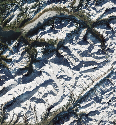 Image:
The ranges and valleys of the Swiss Alps stand out in this image captured by the Copernicus Sentinel-2 mission in December 2024.
Earth from Space: Snow-capped Swiss Alps
7.2.2025 10:00 Image:
The ranges and valleys of the Swiss Alps stand out in this image captured by the Copernicus Sentinel-2 mission in December 2024.
Die Erde aus dem Weltraum: Schneebedeckte Schweizer Alpen
7.2.2025 10:00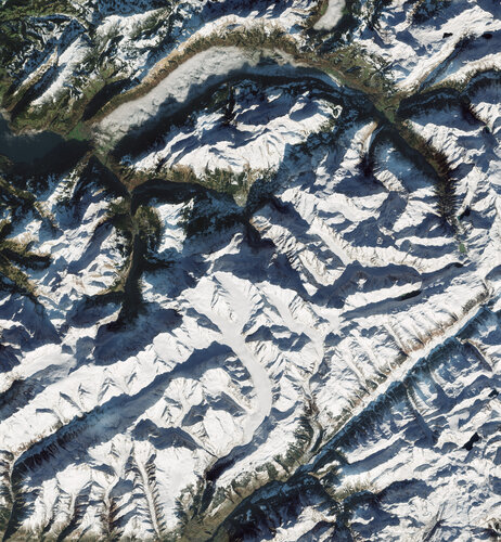 Image:
Die Bergketten und Täler der Schweizer Alpen sind auf diesem Bild zu sehen, das die Copernicus Sentinel-2 Mission im Dezember 2024 aufgenommen hat.
ESA and Finland pave the way towards a supersite for Earth observation
4.2.2025 16:00
Today, ESA, the Finnish government and the Finnish Meteorological Institute took the initial steps towards establishing a ‘supersite’ for Earth observation calibration and validation in Sodankylä in Finnish Lapland.
Envisaged as a joint investment, this world-class site would bring benefits to both ESA, by helping to further ensure satellites deliver accurate data over high latitude environments, and to Finland by providing Finnish businesses with new opportunities to develop and test environmental sensors and technology.
Top 10 persistent methane sources
3.2.2025 8:44
A list of the top 10 global regions where natural or anthropogenic sources emit methane on a continuous, ‘persistent’ basis was recently published in a scientific journal.
Earth from Space: São Francisco River, Brazil
31.1.2025 10:00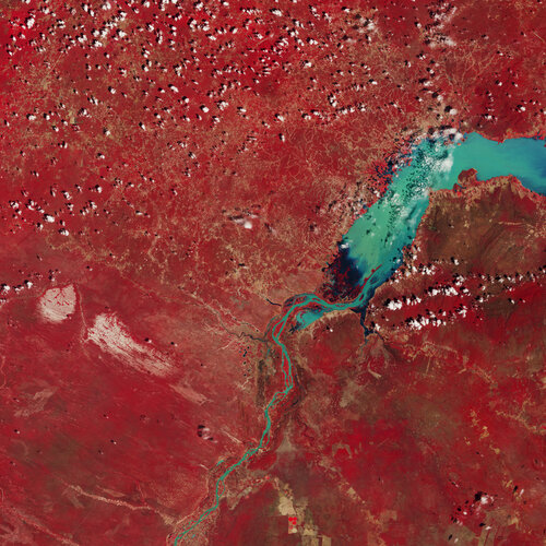 Image:
This Copernicus Sentinel-2 image highlights part of the São Francisco River in eastern Brazil.
19 New Space signatures for Copernicus Contributing Missions
28.1.2025 16:15
Nineteen satellite data companies have signed agreements to provide new or enhanced services to the Copernicus programme in their roles as Copernicus Contributing Missions.
Europe’s carbon dioxide monitoring mission elevated to the power of three
28.1.2025 14:34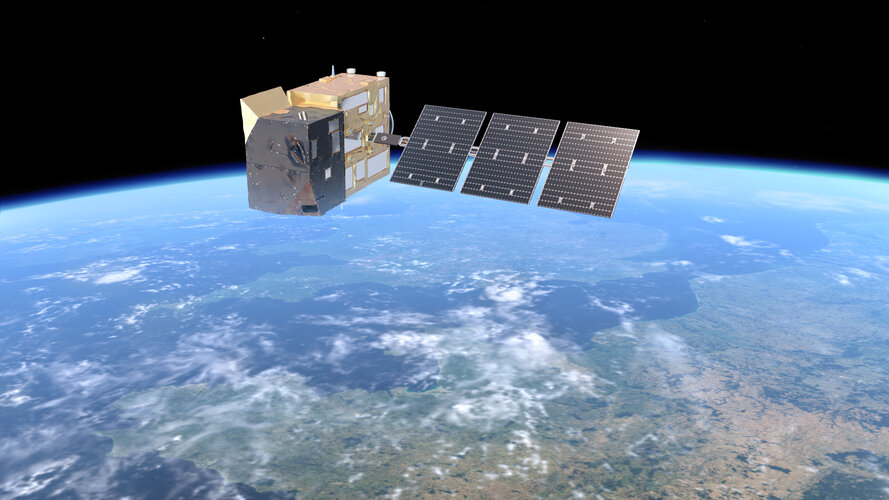
Building on the initial contract to develop two satellites for the Copernicus Anthropogenic Carbon Dioxide Monitoring mission, the European Commission and ESA have now entrusted OHB System AG with the development of a third satellite.
This addition will accelerate global coverage, enabling faster and more comprehensive measurements of carbon dioxide and methane emissions from human activities to enhance the evaluation of climate mitigation efforts.
Ariane 6 to take Sentinel-1D into orbit
28.1.2025 13:16
Entrusted by the European Commission, ESA has signed a contract with Arianespace to secure an Ariane 6 rocket for the launch of the Sentinel-1D satellite, the fourth unit of the Copernicus Sentinel-1 mission, scheduled for the second half of this year.
First MetOp Second Generation satellite to launch in August
28.1.2025 13:15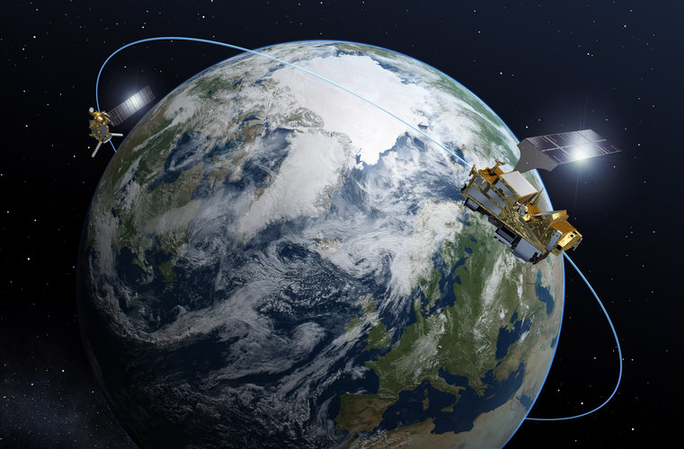
ESA, Eumetsat, the European Commission and Arianespace have announced an agreement to advance the launch of the first MetOp Second Generation weather satellite, which also carries the Copernicus Sentinel-5 mission, to August 2025 aboard an Ariane 6 rocket.
Media invitation: cleanroom visit to MTG-S and Sentinel-4
27.1.2025 15:51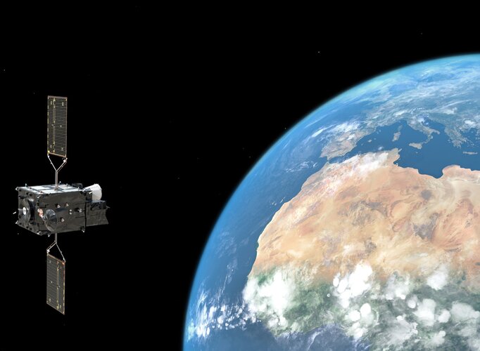
Media invitation: cleanroom visit to MTG-S and Sentinel-4
Smouldering woody debris fuels air pollution over the Amazon
27.1.2025 11:25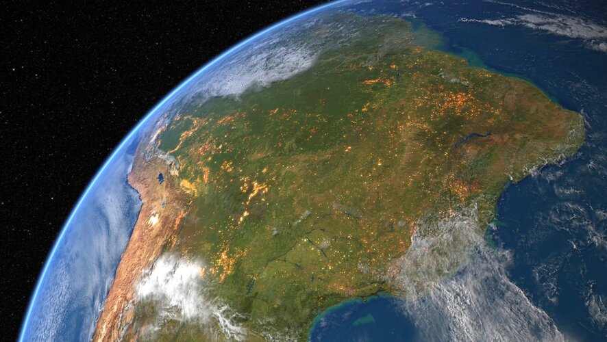
A groundbreaking study, funded by ESA, reveals that fire emissions in the Amazon and Cerrado are largely driven by the smouldering combustion of woody debris. This crucial discovery highlights the significant influence of fuel characteristics on fire emissions, with wide-ranging implications for global carbon cycles, air quality and biodiversity.
Earth from Space: Cyclone Dikeledi
24.1.2025 10:00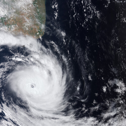 Image:
The Copernicus Sentinel-3 mission captured Cyclone Dikeledi south of Madagascar on 16 January, just a few days after it made landfall on Africa’s southeastern coast causing widespread destruction in several countries and islands.
Media invitation: last chance to see ESA’s Biomass satellite
22.1.2025 14:31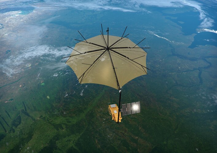
Media invitation: last chance to see ESA’s Biomass satellite
Swarm detects tidal signatures of our oceans
22.1.2025 10:56
A study using data from ESA’s Swarm mission suggests that faint magnetic signatures created by Earth’s tides can help us determine magma distribution under the seabed and could even give us insights into long-term trends in global ocean temperatures and salinity.
Read: Earth Observation Groundbreaking Science Discoveries
21.1.2025 8:50Read: Earth Observation Groundbreaking Science Discoveries
European Space Sciences Committee
Earth from Space: Frozen borders
17.1.2025 10:00 Image:
This Copernicus Sentinel-2 image captures the borders between North and South Dakota and Minnesota blanketed with snow and ice.
EarthCARE goes live with data now available to all
16.1.2025 9:00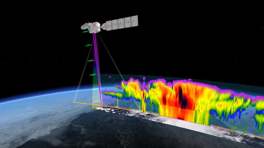
With ESA’s EarthCARE satellite and four measuring instruments all working extremely well and fully commissioned, the mission’s ‘first level’ data stream is now freely available.
By combining data from all four instruments, scientists ultimately aim to address a critical Earth science question: how do clouds and aerosols affect the heating and cooling of our atmosphere?
InCubed launches highlight ESA’s support for innovation
15.1.2025 10:20
Three InCubed satellites have launched from the Vandenberg Space Force Base, California, highlighting ESA’s role as partner to industry and its support for business and technology innovation.
IRIDE pathfinder satellite has launched
15.1.2025 9:00
The first IRIDE satellite – the Pathfinder Hawk – is now in orbit around Earth after lifting off on a SpaceX Falcon 9 rocket from the Vandenberg Space Force Base in California on 14 January.
As its ‘Pathfinder’ name suggests, this new microsatellite is a prototype for one of the six IRIDE constellations, which are tailored to provide information for a wide range of environmental, emergency and security services for Italy.
Los Angeles struggles to contain wildfires
10.1.2025 15:40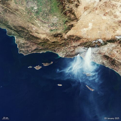 Image:
Five wildfires are still currently burning (as of 10 January) in areas of north Los Angeles. This image, captured by the Copernicus Sentinel-3 mission on 9 January 2025, shows the Palisades and the Eaton fires, with smoke seen reaching Catalina Island and the Santa Barbara reserve.
Los Angeles ablaze
8.1.2025 12:17 Image:
Fanned by very strong winds, a wildfire is ripping through the Pacific Palisades in Los Angeles, California. This image captured by the Copernicus Sentinel-2 mission vividly depicts the smoke billowing from the fire near Santa Monica on 7 January 2025, not long after the fire broke out.
Top Earth observation stories of 2024
23.12.2024 9:00
This year has been a whirlwind of fascinating Earth observation stories, from dramatic volcanic eruptions to Saharan dust plumes to epic meteorite craters. Let’s dive into some of the most memorable highlights from 2024.
ESA and NASA deliver first joint picture of Greenland Ice Sheet melting
20.12.2024 15:01
Global warming is driving the rapid melting of the Greenland Ice Sheet, contributing to global sea level rise and disrupting weather patterns worldwide. Because of this, precise measurements of its changing shape are of critical importance for adapting to climate change.
Now, scientists have delivered the first measurements of the Greenland Ice Sheet’s changing shape using data from ESA's CryoSat and NASA's ICESat-2 ice missions.
Earth from Space: Star cities
20.12.2024 10:00 Image:
With the festive season approaching, even Earth-observing satellites are getting into the spirit, capturing a stunning compilation of European cities that resemble stars.
ESA signs launch contract for climate mission FORUM with Avio
18.12.2024 16:39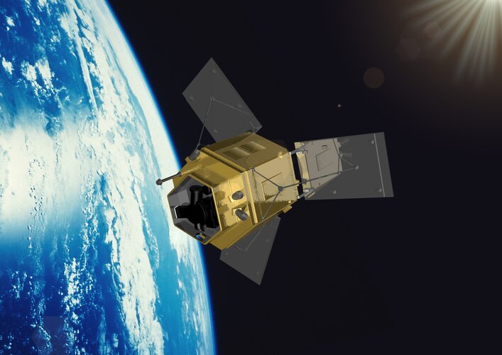
ESA has officially signed a launch service contract with Avio for the upcoming FORUM mission. Scheduled for launch in late 2027, FORUM—short for Far-infrared Outgoing Radiation Understanding and Monitoring—will lift off on a Vega-C rocket from Europe’s Spaceport in French Guiana.
Earth from Space: Jakobshavn Glacier, Greenland
13.12.2024 10:00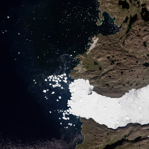 Image:
These summer images from the Copernicus Sentinel-2 and Sentinel-1 missions showcase different satellite views of Greenland’s west coast.
High-altitude balloon ride offers new perspective for CAIRT
12.12.2024 8:30
A novel sensor that simulates the measurements that would be taken by one of the proposed satellites vying to be ESA’s eleventh Earth Explorer, has endured an extraordinary journey.
Carried aboard a high-altitude balloon on a four-day voyage from Sweden to Canada, the sensor provides new data that could help to refine the CAIRT mission concept – a mission that aims to unravel the complexities of Earth's atmosphere and enhance our understanding of climate dynamics.
AI-powered satellite data reveals clouds in 3D
11.12.2024 14:45
Launched in May 2024, ESA’s EarthCARE satellite is nearing the end of its commissioning phase with the release of its first data on clouds and aerosols expected early next year. In the meantime, an international team of scientists has found an innovative way of applying artificial intelligence to other satellite data to yield 3D profiles of clouds.
This is particularly news for those eagerly awaiting data from EarthCARE in their quest to advance climate science.
Sentinel-1C captures first radar images
10.12.2024 11:11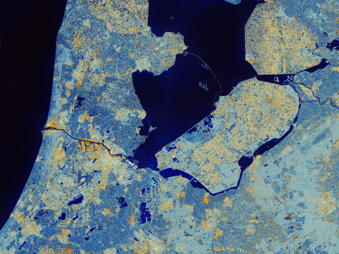
Less than a week after its launch, the Copernicus Sentinel-1C satellite has delivered its first radar images of Earth – offering a glimpse into its capabilities for environmental monitoring. These initial images feature regions of interest, including Svalbard in Norway, the Netherlands, and Brussels, Belgium.
UK methane leak spotted using satellites
9.12.2024 9:40
Researchers from the University of Leeds have detected methane leaking from a faulty pipe in Cheltenham, Gloucestershire, UK, using GHGSat satellite data – part of ESA’s Third Party Mission Programme. This marks the first time a UK methane emission has been identified from space and successfully mitigated.
Earth from Space: First seasonal snow
6.12.2024 10:00 Image:
This Copernicus Sentinel-2 image from 21 November 2024 captures the first snow of the season over Denmark and southern Sweden.
Vega-C and Sentinel-1C launch highlights
6.12.2024 9:30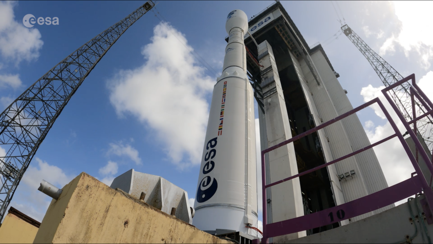 Video:
00:03:40
The third Copernicus Sentinel-1 satellite, Sentinel-1C, has launched aboard a Vega-C rocket, flight VV25, from Europe’s Spaceport in French Guiana. The rocket lifted off on 5 December 2024 at 22:20 CET (18:20 local time).
Sentinel-1C extends the legacy of its predecessors, delivering high-resolution radar imagery to monitor Earth’s changing environment, supporting a diverse range of applications and advance scientific research. Additionally, Sentinel-1C introduces new capabilities for detecting and monitoring maritime traffic.
The launch also marks Vega-C’s ‘return to flight’, a key step in restoring Europe’s independent access to space. Vega-C is the evolution of the Vega family of rockets and delivers increased performance, greater payload volume and improved competitiveness.
Double win for Europe: Sentinel-1C and Vega-C take to the skies
6.12.2024 0:15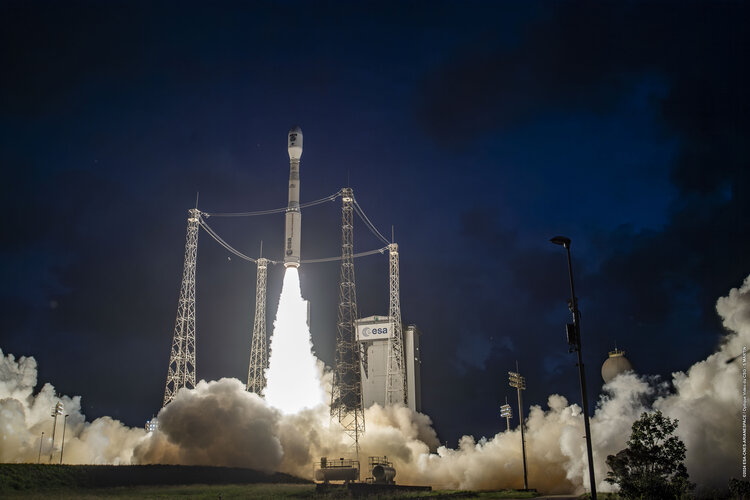
The third Copernicus Sentinel-1 satellite was launched on a Vega-C rocket from Europe’s Spaceport in French Guiana. Sentinel-1C extends the legacy of its predecessors, delivering high-resolution radar imagery to monitor Earth’s changing environment, supporting a diverse range of applications and advancing scientific research. Additionally, Sentinel-1C introduces new capabilities for detecting and monitoring maritime traffic.
Double win for Europe: Sentinel-1C and Vega-C take to the skies
6.12.2024 0:15
The third Copernicus Sentinel-1 satellite was launched on a Vega-C rocket from Europe’s Spaceport in French Guiana. Sentinel-1C extends the legacy of its predecessors, delivering high-resolution radar imagery to monitor Earth’s changing environment, supporting a diverse range of applications and advancing scientific research. Additionally, Sentinel-1C introduces new capabilities for detecting and monitoring maritime traffic.
Double win for Europe: Sentinel-1C and Vega-C take to the skies
6.12.2024 0:15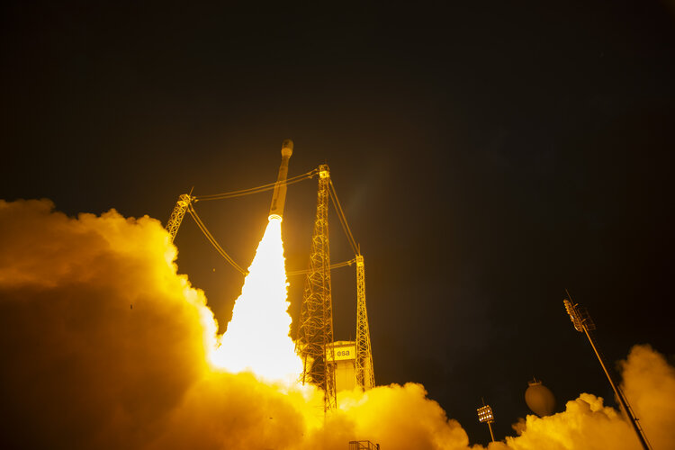
The third Copernicus Sentinel-1 satellite was launched on a Vega-C rocket from Europe’s Spaceport in French Guiana. Sentinel-1C extends the legacy of its predecessors, delivering high-resolution radar imagery to monitor Earth’s changing environment, supporting a diverse range of applications and advancing scientific research. Additionally, Sentinel-1C introduces new capabilities for detecting and monitoring maritime traffic.
Double win for Europe: Sentinel-1C and Vega-C take to the skies
6.12.2024 0:15
The third Copernicus Sentinel-1 satellite was launched on a Vega-C rocket from Europe’s Spaceport in French Guiana. Sentinel-1C extends the legacy of its predecessors, delivering high-resolution radar imagery to monitor Earth’s changing environment, supporting a diverse range of applications and advancing scientific research. Additionally, Sentinel-1C introduces new capabilities for detecting and monitoring maritime traffic.
Sentinel-1C launches on Vega-C
5.12.2024 22:20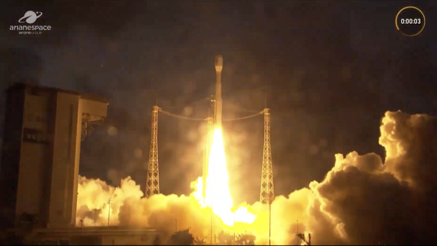 Video:
00:02:40
The third Copernicus Sentinel-1 satellite, Sentinel-1C, has launched aboard a Vega-C rocket, flight VV25, from Europe’s Spaceport in French Guiana. The rocket lifted off on 5 December 2024 at 22:20 CET (18:20 local time).
Sentinel-1C extends the legacy of its predecessors, delivering high-resolution radar imagery to monitor Earth’s changing environment, supporting a diverse range of applications and advance scientific research. Additionally, Sentinel-1C introduces new capabilities for detecting and monitoring maritime traffic.
The launch also marks Vega-C’s ‘return to flight’, a key step in restoring Europe’s independent access to space. Vega-C is the evolution of the Vega family of rockets and delivers increased performance, greater payload volume and improved competitiveness.
Sentinel-1C launches on Vega-C
5.12.2024 22:20 Video:
00:02:40
The third Copernicus Sentinel-1 satellite, Sentinel-1C, has launched aboard a Vega-C rocket, flight VV25, from Europe’s Spaceport in French Guiana. The rocket lifted off on 5 December 2024 at 22:20 CET (18:20 local time).
Sentinel-1C extends the legacy of its predecessors, delivering high-resolution radar imagery to monitor Earth’s changing environment, supporting a diverse range of applications and advance scientific research. Additionally, Sentinel-1C introduces new capabilities for detecting and monitoring maritime traffic.
The launch also marks Vega-C’s ‘return to flight’, a key step in restoring Europe’s independent access to space. Vega-C is the evolution of the Vega family of rockets and delivers increased performance, greater payload volume and improved competitiveness.
Relive Sentinel-1C on Vega-C launch
4.12.2024 22:20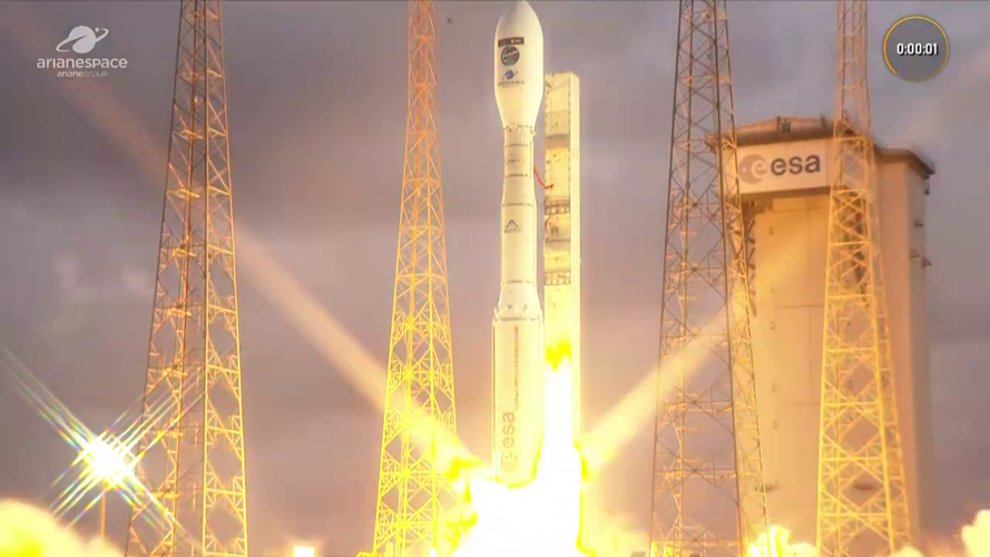 Video:
02:31:24
The third Copernicus Sentinel-1 satellite, Sentinel-1C, launched aboard a Vega-C rocket, flight VV25, from Europe’s Spaceport in French Guiana on 5 December 2024 at 22:20 CET (18:20 local time).
Sentinel-1C extends the legacy of its predecessors, delivering high-resolution radar imagery to monitor Earth’s changing environment, supporting a diverse range of applications and advance scientific research. Additionally, Sentinel-1C introduces new capabilities for detecting and monitoring maritime traffic.
The launch also marks Vega-C’s ‘return to flight’, a key step in restoring Europe’s independent access to space. Vega-C is the evolution of the Vega family of rockets and delivers increased performance, greater payload volume and improved competitiveness.
ESA teams up with Massive Attack to boost climate action
2.12.2024 15:43
A mesmerising audiovisual experience from trip-hop collective Massive Attack that blends an original score with stunning satellite images of Earth was enjoyed by thousands of climate enthusiasts in Liverpool.
Watch live: Vega-C to launch Sentinel-1C
29.11.2024 15:15
The Copernicus Sentinel-1C satellite is ready for liftoff! Tune in to ESA WebTV on 4 December from 22:00 CET to watch the satellite soar into space on a Vega-C rocket to be launched from Europe’s Spaceport in Kourou, French Guiana. Sentinel-1C is scheduled to liftoff at 22:20 CET.
Watch live: Vega-C to launch Sentinel-1C
29.11.2024 15:15
Update: launch postponed to Thursday 5 December 2024.
Due to a mechanical issue preventing the withdrawal of the mobile gantry, the launch chronology has been stopped.
The earliest targeted launch date is planned for tomorrow Thursday 5 December 2024 at 22:20 CET (18:20 local time in Kourou). The launcher and its passenger the Copernicus Sentinel-1C satellite are in stable and safe conditions.
Tune in to ESA WebTV on 5 December from 22:00 CET to watch the satellite soar into space on a Vega-C rocket to be launched from Europe’s Spaceport in Kourou, French Guiana.
Earth from Space: Agricultural patchwork, Romania
29.11.2024 10:00 Image:
A colourful patchwork of agricultural fields is pictured in this radar image captured by Copernicus Sentinel-1 over southeastern Romania.
How do radar satellites work?
28.11.2024 16:20 Video:
00:07:33
Radar allows us to see through what would otherwise be invisible. By sending out radio waves that bounce off objects and return as echoes, radar creates a detailed picture of our surrounding world.
This technology is everywhere: from guiding air traffic and enabling self-driving cars to tracking the movements of athletes. But its reach doesn’t stop there—radar is also transforming how we observe our Earth from space.
Satellites like the Copernicus Sentinel-1 mission use radar to see through clouds, darkness and any weather conditions. This capability is invaluable for detecting subtle changes on Earth’s surface—changes that are often hidden from the human eye. Discover how radar technology is helping us unlock these hidden insights about our planet.
Taking to the skies for EarthCARE
28.11.2024 14:45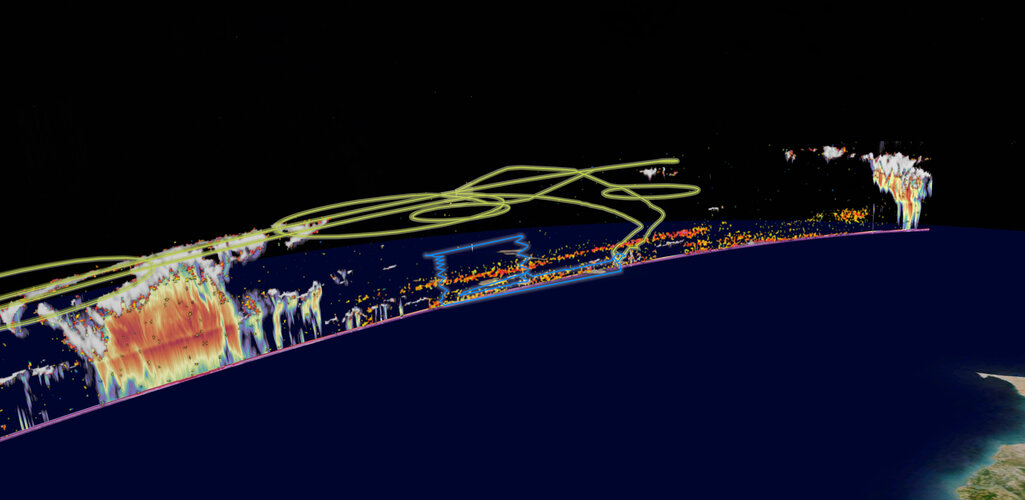
Launched just six months ago and still in its commissioning phase, ESA’s EarthCARE satellite is already producing remarkable data from its four instruments, offering groundbreaking insights into clouds, aerosols, and Earth’s energy balance.
Highlighting the importance to Earth system science and climate research, teams worldwide are out in force taking measurements to verify and enhance the accuracy of EarthCARE’s data.
Taking to the skies for EarthCARE
28.11.2024 14:45
Launched just six months ago and still in its commissioning phase, ESA’s EarthCARE satellite is already producing remarkable data from its four instruments, offering groundbreaking insights into clouds, aerosols, and Earth’s energy balance.
Highlighting the importance to Earth system science and climate research, teams worldwide are out in force taking measurements to verify and enhance the accuracy of EarthCARE’s data.
Sentinel-1C pre-launch media briefing
27.11.2024 16:30 Video:
00:56:21
Watch the replay of the Sentinel-1C pre-launch media briefing for detailed information on the mission which will be launched aboard a Vega-C rocket no earlier than 4 December at 18:20 local time (22:20 CET) from Europe’s Spaceport in Kourou, French Guiana.
Watch live: Sentinel-1C pre-launch media briefing
27.11.2024 12:20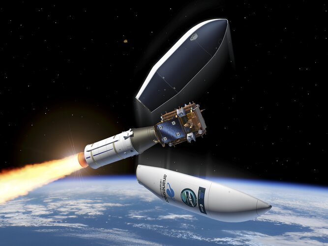
Watch live: Sentinel-1C pre-launch media briefing
Follow the media briefing today at 15:00 CET on ESA Web TV
ESA awards development contract for NanoMagSat
27.11.2024 11:30
Today, the ESA awarded a contract to Open Cosmos to design, build, launch and commission the NanoMagSat Scout satellites. This new mission will uphold Europe’s leadership in monitoring Earth’s magnetic field and contribute to applications such as space weather hazard assessment, navigation, directional drilling, and more.
10 ways Sentinel-1 data lets us ‘see’ our world
27.11.2024 9:10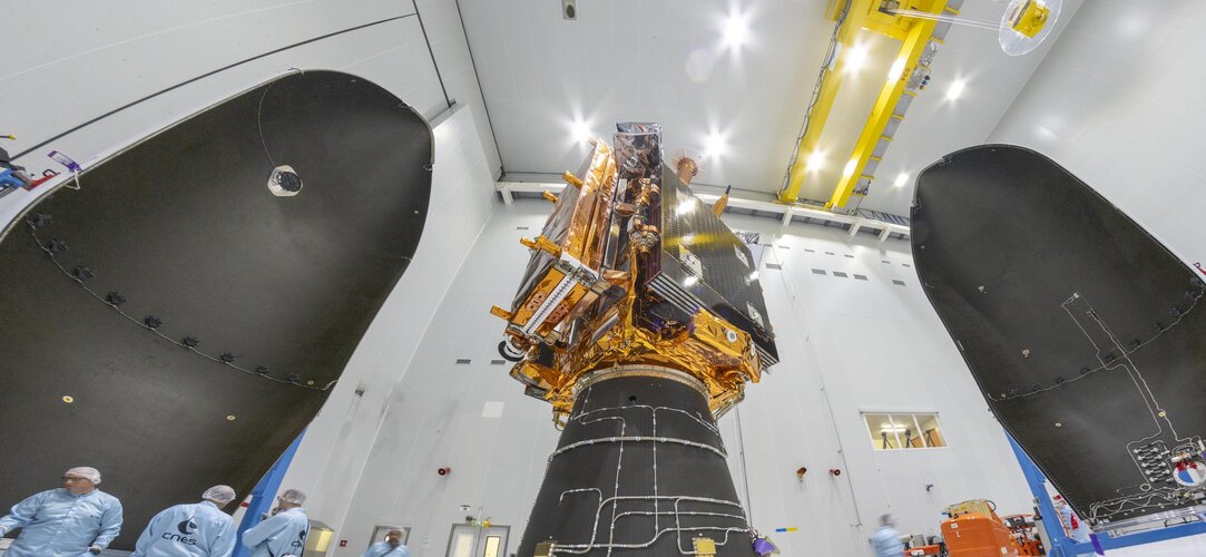
As the launch of the Sentinel-1C satellite approaches, we reflect on some of the many ways the Copernicus Sentinel-1 mission has given us remarkable radar insights into our planet over the years.
10 ways Sentinel-1 data lets us ‘see’ our world
27.11.2024 9:10
As the launch of the Sentinel-1C satellite approaches, we reflect on some of the many ways the Copernicus Sentinel-1 mission has given us remarkable radar insights into our planet over the years.
Watch live: ESA’s Earth Observation Commercialisation Forum
26.11.2024 9:10
Watch selected sessions of ESA’s Earth Observation Commercialisation Forum on ESA Web TV.
Taking place this week at KAP Europa in Frankfurt, Germany, from 27 to 28 November 2024, end users, institutions, entrepreneurs and companies from the Earth observation sector will come together to discuss the commercial potentials and challenges of the fast-growing Earth observation commercial space sector.
Media invitation: Sentinel-1C pre-launch media briefings
22.11.2024 14:39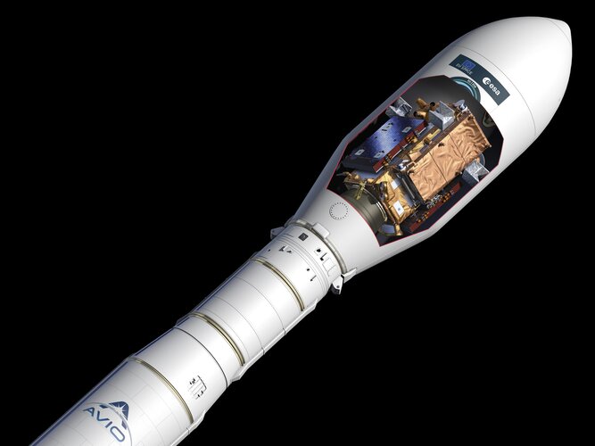
Media invitation: Sentinel-1C pre-launch media briefings
Earth from Space: ‘Angry husband’ eruption
22.11.2024 10:00 Image:
This Copernicus Sentinel-2 image from 13 November 2024 shows the Lewotobi Laki Laki volcano eruption on the island of Flores in southern Indonesia.
Copernicus Sentinel-1: radar vision for Copernicus
21.11.2024 15:00 Video:
00:07:25
Meet Copernicus Sentinel-1 – this ground-breaking mission delivers continuous, all-weather, day-and-night imaging for land, ice and maritime monitoring.
Equipped with state-of-the-art C-band synthetic aperture radar (SAR), Sentinel-1 captures high-resolution data around the clock, in any weather, making it indispensable for detecting the subtle changes on Earth’s surface that remain hidden from the human eye.
Sentinel-1 data serves a multitude of critical applications: from ensuring the safety and efficiency of maritime traffic, tracking sea ice and icebergs, to monitoring structural integrity and natural hazards, such as earthquakes, landslides and volcanic activity.
Its enhanced radar technology provides precises precise information on ground movement, which is critical for urban planning, infrastructure resilience, subsidence risk assessment and geohazard monitoring.
Through consistent, long-term data collection, Sentinel-1 serves as a global asset, essential for environmental and safety monitoring worldwide. The mission is a beacon of innovation, advancing our understanding of our planet’s dynamic landscape.
This video features interviews with Mark Drinkwater, Head of Mission Sciences Division at ESA, Ramon Torres Cuesta, Sentinel-1 Project Manager at ESA and Julia Kubanek, Sentinel-1 Mission Scientist at ESA.
Destination Earth awarded
20.11.2024 15:32
Destination Earth awarded
DestinE receives honours in HPCwire Readers’ and Editors’ Choice Awards
Space for Shore: Sentinel-1 reveals Arctic glacier retreat
19.11.2024 13:37
As Arctic temperatures rise, marine-terminating glaciers—especially in places like Svalbard—are undergoing rapid retreat and intensified calving.
The ESA-funded Space for Shore project utilises radar data from the Copernicus Sentinel-1 mission to provide precise, year-over-year insights into glacier retreat and calving intensity, particularly in areas like Kongsfjorden, where notable glaciers are experiencing significant retreat.
Sentinel-1C fuelled ahead of liftoff
18.11.2024 9:00
Marking a major milestone in the preparation of Copernicus Sentinel-1C for its scheduled 3 December liftoff, experts have completed the critical and hazardous process of fuelling the satellite.
Once in orbit, Sentinel-1C will extend the Sentinel-1 mission’s legacy, delivering radar imagery to monitor Earth’s changing environment to support a diverse range of applications and scientific research. Additionally, Sentinel-1C brings new capabilities for detecting and monitoring maritime traffic
Earth from Space: Clouds or snow?
15.11.2024 10:00 Image:
These two images acquired by Copernicus Sentinel-2 highlight how the mission can help distinguish between clouds and snow.
ESA signs contracts advancing Greece’s Earth observation capabilities
14.11.2024 14:00
Today, the European Space Agency signed six contracts that will help position Greece as a key player in the field of Earth observation.
Extreme heat weakens land’s power to absorb carbon
13.11.2024 9:00
A new European Space Agency-backed study shows that the extreme heatwaves of 2023, which fuelled huge wildfires and severe droughts, also undermined the land’s capacity to soak up atmospheric carbon. This diminished carbon uptake drove atmospheric carbon dioxide levels to new highs, intensifying concerns about accelerating climate change.
CHIME given the shakes
12.11.2024 15:00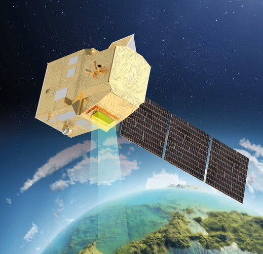
A model of the CHIME instrument has recently undergone rigorous testing to confirm it can endure the stresses of launch and the harsh conditions of space. This new Copernicus mission will provide critical data to support sustainable agriculture, and more.
Earth from Space: Autumn foliage across Europe
8.11.2024 10:00
This compilation of images, captured by the Copernicus Sentinel-2 mission, showcases the characteristic hues of autumn in different European countries.
Devastating floods in Spain witnessed by satellites
5.11.2024 16:35
Torrential rainfall causing deadly flash floods has hit southern and eastern Spain in regions including the Costa del Sol, where the city of Malaga is located, and Valencia in the east. As these areas struggle to cope with the aftermath, satellite technology has played a crucial role in assessing the damages of the affected areas.





 Image:
Mandalay rupture
 Image:
Biomass cleared for fuelling
 Image:
Biomass out of the box
 Image:
Three MetOp-SG-B weather siblings
 Image:
Snow returns to Mount Fuji